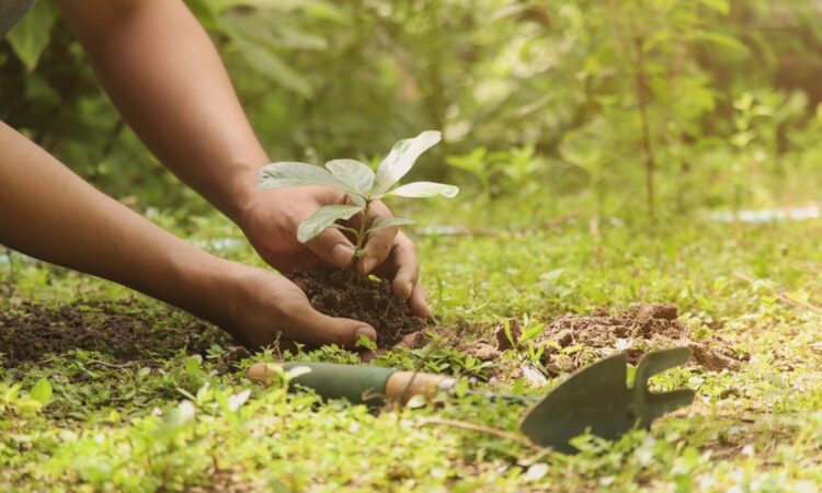
It is, basically, helping nature fix what humans, in our glory, have broken. The objective is to restore indigenous plants and animals along with natural processes that sustain a healthy ecosystem. This is not about sprucing things up or ‘greening’ an area. It’s about restoring that ecological balance so that the land can sustain diverse life, pure water and air, and even mitigate climate change. Projects can be as simple as planting native trees in a city park, or restoring grasslands or wetlands stripped of their native flora.
A key part of restoration is employing a reference ecosystem. It’s an actual or recreated ecosystem that demonstrates what a healthy system should look like there. By examining factors such as plant coverage, soil vitality, and species composition, teams can establish tangible goals for restoration. So, say you’re restoring a wetland in South America, your reference would be a local neighboring wetland that’s never been altered by agriculture or construction. These help establish targets for evaluating success and inform choices about what species to reintroduce.
Restoration success is typically measured by examining indicator species, such as the quantity of native plants, their distribution, or coverage. These indicators, over time, assist in indicating whether the ecosystem is beginning to approach the reference. Merely measuring what’s growing is insufficient. Track ecological processes. These are things like infiltration (water soaking into the soil), nutrient cycling, or support for pollinators and wildlife. Combining composition and process-based indicators provides a more complete view of ecosystem functioning.
As nature is complex and ever-changing, adaptive management is now fundamental in restoration. This translates to teams checking in frequently—through monitoring and feedback—to determine if what they’re doing is effective. If something’s not working, they adjust and continue monitoring outcome. So, if adding native trees in a dry area isn’t increasing soil moisture, the team could experiment with other species or alter their planting strategy. It’s a strategy that works beautifully, in particular in dry or semi-dry locations where regeneration is slow and difficult to forecast.
Restoration does not occur in isolation. Social, cultural and economic needs have to be included in the planning. What works in one country or community may not fit elsewhere. Sometimes local people depend on the land for sustenance or employment, so their requirements and expertise determine what success is. Restoration work can involve not only restoring flora and fauna but restoring communities.
Indicators of restoration success
We require restoration success indicators to indicate whether an ecosystem restoration effort is successful. Scientists and their field teams apply sets of indicators that mirror both the living components (such as flora and fauna) and the physical landscape components (such as soil and water). These markers work best when paired and compared to initial measurements, so progress is followed evenly.
Biological indicators
Restoration success is often defined by what grows and lives on a site. Species diversity — what kind and how many kinds of plants and animals there are — and abundance — how many of each. For instance, a rehabilitated grassland would exhibit greater species diversity among grasses, wildflowers and insects than it previously. Some projects target keystone species—species that have a significant impact on the entire ecosystem, such as bees in a meadow or giant fruit trees in a rainforest. Teams often measure not only the species count but cover — the amount of space a given plant takes up — its density, or even its biomass (total weight). Short-term checks can sometimes fool people, so long-term tracking is key. Research has found that initial plant counts can indicate a project failed or succeeded, but outcomes may be different over time if underlying ecosystem shifts are overlooked.
Physical and chemical indicators
Restoration is more than just what’s alive. Shifts in soil and water matter equally. Soil stability — how well the ground stays put against wind and rain — is a fundamental measure. If a hillside used to shed topsoil in storms, a restored slope should shed less soil after planting. Water quality is another key sign. Cleaner streams, with less sediment or lower levels of chemicals, signal better ecosystem health. Nutrient cycling — for example, how rapidly dead leaves decompose to feed new growth — counts. For instance, healthy fungal activity in ground indicates that nutrient cycling is happening effectively, which fuels plant life and can even aid ecosystems in adapting once climates shift again.
Ecosystem function indicators
Process-based markers are catching on because they demonstrate how well the system works as a whole. These metrics include pollination rates — which indicate whether plants can reproduce — and carbon sequestration — which tracks whether the land stores more carbon in soil and trees. These markers can catch changes in fundamental ecosystem traits: how stable the soil is, how water moves through the system, and how well living things thrive. For example, a forest where birds, bats, and insects pollinate many plants is probably healthier than one without these services. These process-based checks can sometimes provide a more genuine feeling of success than simply cataloging plant species, as they demonstrate the interaction between life and the land.
Long-term monitoring strategies
Long-term monitoring is critical to understanding the dynamics of restored ecosystems. Most systems respond in indirect and unpredictable ways. Short-term checks can miss big shifts, like the sudden loss of a key species or emergence of a new ecosystem form. Only long-term data can catch these changes, particularly as climate change adds additional stress. Early indications can seem favorable or unfavorable, but these can reverse over time. Western U.S. Studies, some extending 75 years in duration, reveal how simply tallying plant types can lead astray. Real recovery requires more than a snapshot.
- Set clear objectives and timelines
Begin with your goal. Determine what ‘success’ means for the site. Set objectives that are simple to quantify, such as “increase soil stability by 10% over five years,” or “achieve 80% survival rates of planted saplings by year three.” Break down each goal into steps. Connect each to a timeline, so you know when to check in. This simplifies the process of determining whether you’re on course, or need to adjust. Edit goals as you experience the land and experience new data.
- Use standardized protocols
Apply the same data collection rules each time and at each location. That covers how you sample plants, probe soil, or log water flow. Track record to follow publish methods so others can repeat it. This facilitates comparing place to place or year to year. For instance, use the same plot size for plant counts or standard probes for soil moisture. That way results remain equitable and effective in the long run.
- Schedule regular monitoring intervals
Decide how often to visit the site for monitoring purposes–annually, seasonally, or even monthly in sensitive sites. Combine short and long time horizons to identify immediate solutions as well as major trends. For example, the annual checks may identify plant growth, whereas the ten-year reviews may identify soil changes or new ecosystem types. Distribute checks over multiple years to detect gradual or abrupt changes, such as a severe drought that may alter the entire system within a single year.
- Support adaptive management
Utilize the information to guide decisions, not simply to populate reports. If goals aren’t met, change what you do. – if planted trees keep on dying, try new species or planting time. If soil continues to wash away, add check dams or mulch. Disseminate results widely, to all interested parties, from local workers to outside consultants. This keeps the project open to innovation and more suitable to local requirements.
Collaborate with all parties, especially when the site sits on Indigenous land or local groups use it. Ensure the monitoring scheme suits all your values and needs. Employ plant and process indicators—monitor water flow, soil retention, animal utilization, etc. This provides a complete overview of what’s actually evolving.
Integrating traditional and scientific knowledge
Combining traditional and Indigenous knowledge with scientific work has emerged as one of the most effective ways to improve and extend ecological restoration work. Traditional ecological knowledge (TEK) is accumulated across generations. It supports communities in adapting to transformations in their land and climate. Such deep, place-based knowledge can fill holes in scientific data, particularly in areas where formal monitoring is difficult. Scientists are now working more with tribal and local communities, both to learn from their experience and to ensure restoration work aligns with local needs and values.
TEK provides an intimate perspective of the human utilization and stewardship of nature. Many traditional groups know what plants serve best as pioneer plants. There, for instance, local folk may identify Bombax ceiba, Albizia lebbeck or Dillenia indica as the answer to regreening forests. These species grow rapidly on nutrient-deficient soil and initiate new cycles of life. On most projects, 69 per cent of the species introduced into new corridors are connected to Indigenous cultures through food, medicine or their use in buildings. This illustrates how cultural connections influence the selection of plants or trees, lending restoration greater significance and increasing the chances of success.
Harvesting and applying TEK extends well beyond plant catalogues. Local people sometimes monitor fluctuations in animal populations, soil quality and water currents. They rely on this knowledge to inform their plant or resource harvesting schedules. This knowledge could be used to help inform adaptive plans and long-term monitoring. When scientists and local people collaborate, it results in both richer data and greater trust. For instance, community members may observe shifts in water timing or animal trails earlier than remote sensors detect them. Such real-time feedback allows managers to adjust plans rapidly, making the restoration process more adaptable.
Scientist-community partnerships are a huge piece of this. Co-management means all of us get to decide what to restore, how to measure it, and how success looks. Local knowledge often assists in identifying issues more quickly like the proliferation of invasive species, or the disappearance of vital plants. Meanwhile, scientists can supplement with tools such as mapping, remote sensing or genetic tests to construct a more complete portrait. These partnerships result in mutual benefits — like improved food security or new restoration-linked jobs.
Examples of integrating traditional ecological knowledge with scientific methods:
- Collaborating with locals to select tree and plant species for restoration because of cultural, nutritional or medicinal worth
- TEK to identify the early indicators of changes in soil, water, or animal life.
- Incorporating Indigenous knowledge
- Merging the Indigenous tracking of animal trails with GPS and camera traps
- and incorporating, for example, traditional rules for harvesting or land use into new management plans.
- Training local youth in science and TEK so knowledge stays robust
Technology in monitoring and assessment
Technology now plays a big role in how we check and track the work done to bring back damaged land or water. New tools help us see big changes, spot trouble early, and collect more data than before. This keeps the work honest and helps experts make smart choices, no matter where the project is or what type of ecosystem is being fixed.
Remote sensing technologies such as drones and satellite imagery allow teams to monitor vast regions quickly and in high resolution. These tools have expanded tremendously over the last two decades. Remote sensing provides a broad collection of images and information that assist in mapping and quantifying factors such as vegetation cover, forest health, and deforestation. For instance, with the proper images it can monitor 11 of the 18 items measured in the ecological recovery wheel. This encompasses plant growth and land shape, and even animal movement. High-resolution RGB and thermal drone images are perfect for locating and enumerating animals that should be there. Drones can fly low and capture crisp images, while satellites scan much larger areas, sometimes more than 10 km square. This is a huge advance over ground-based work, which typically covers less than 1 square km and loses the broader context.
Environmental sensors are another crucial tool. They’re little sensors that sit in the field and relay back real-time stats on soil moisture, temperature, air quality, light, etc. They aid in detecting shifts quickly, like dry spells or a rapid decline in soil health. This allows you to detect and address problems early before they escalate. Sensors can be distributed across a site to monitor multiple locations simultaneously, providing a more comprehensive overview of ecosystem recovery.
A blend of technology in real projects. Here are some common options:
- Drones: for aerial photos, videos, and thermal scans of plants and animals.
- Satellites: for wide-area tracking and spotting long-term trends.
- Ground sensors: for measuring soil, air, and water changes up close.
- Handheld GPS: for mapping and tracking on-site.
- Camera traps: for tracking animal movement and numbers.
- Data platforms: for storing, sharing, and sorting all the data gathered.
Data management platforms are as valuable as the sensors and cameras. These platforms assist teams in organizing, storing, and analyzing overwhelming quantities of data. They simplify the ability to visualize trends, communicate results to others, and identify areas in greatest need of work. This time-saving and error-reducing. When all parties see the same data, it becomes easier to plan next steps and demonstrate what is working.
No tool works in isolation. Certain things, such as gene flow between plant groups, are difficult to monitor from the sky. Which means teams still have to do ground checks and blend old-school field work with new tech. Incorporating multiple tools and techniques provides the most comprehensive perspective on a project’s progress and what should be tackled next.
Overcoming monitoring challenges
Ecological restoration projects are often subject to hard limits in both funding and staff. Most sites cannot monitor all of the changes over all of the years. Choosing what to follow is crucial. During most projects, attention remains on plant cover or what species turn up. Research reveals that even simply monitoring plant communities can be deceptive. Some sites identified as failures by plant data alone turn out to be successes once other elements are verified. Yet some ‘single-source’ plant ‘successes’ fail after all. To get around this, a lot of experts are now advocating for a combination of plant and process-based measures. Observing not only the plants but the site processes such as soil health, water flow and animal impact provides a more complete perspective.
Resource constraints require invention. Volunteer networks, student organizations and citizen science can help address monitoring shortfalls. These communities can assist in field monitoring or tracking shifts. Training volunteers is key, so that all gathers data in the same manner. Pooling resources among agencies, nonprofits and local groups can help stretch budgets and staff. In certain cases, regional alliances have resulted in joint monitoring schemes that distribute expenses and responsibilities.
It requires more than just good intentions to get reliable, useful data. Projects tend to have holes in the data. Various tribes could employ different instruments, techniques or periods of time, making it difficult to reconcile their results. Standardizing when and how to collect data helps a lot. Direction such as a ten-step, iterative approach can help teams plan, collect and evaluate data in a consistent manner. This type of approach assists in identifying early gaps and provides a defined route for modifications. By sharing data and approaches with other teams—via open databases or periodic conferences—help address these gaps and enhance findings. Input from other stakeholders is key as well. Local professionals, landowners and citizens can pitch in on what signs count for every project, making the entire thing more significant and sustainable.
Monitoring in remote or risky areas is another challenge. Certain sites are difficult to access or even dangerous to workers. New tools assist in this regard. Drones can map plant cover or monitor soil loss. Tiny sensors can monitor water flow, soil moisture, or even animal movement in real time. Locals, who know the land best, can often assist with consistent monitoring on the ground. Leveraging local expertise renders fieldwork less dangerous and less expensive.
Long-term commitment is a frequent stumbling block. Restoration projects outlive funding cycles or those in charge. Building partnerships with universities, government groups, and local groups can sustain programs. Multi-year funding or endowments help, but partners engagement is just as crucial. Adaptive management, where teams review, learn and adjust as they go, is now widely understood to be essential for sustainable impact. Pilot studies support the necessity of monitoring process-based indicators, rather than relying exclusively on plant data, to monitor progress and guide future action.
Case studies and lessons learned
Ecological restoration is a blending of science and practice. From case studies and lessons learned, success often boils down to their teams’ ability to set clear goals, select appropriate measures of change, and remain adaptable to shifting circumstances. The case studies and lessons learned below emphasize what works and what does not, and how both local communities and ongoing verification make or break long-term gains.
One of my favorite examples, from South Africa’s fynbos region, demonstrated the power of good planning and monitoring progress. Teams there had been tasked with restoring native shrubland after decades of agriculture and invasive weed expansion. They started with a ten-step, repeatable plan: first, they mapped out clear goals and picked indicators, like native plant cover and soil health. Next, they established both short and long-term monitoring, checking not only plant growth but also soil stability and water flow. This generalized strategy allowed them to identify early successes and challenges and pivot strategies as necessary. In the end, the most careful checks and open plans sites had the strongest, most long-lasting gains.
Projects in arid and semi-arid areas, such as portions of central Australia and the southwestern US, have demonstrated that one-off fixes don’t endure. For instance, simply pulling shrubs and reseeding grass infrequently restores actual desert grassland. Not to mention, without peeping below to deeper soil and water action, teams frequently experienced rapid but ephemeral green explosions. It was only those who joined plant-focused checks with indicators of robust soil and water cycles who witnessed actual, sustained transformation. That’s why sampling plant checks with tests for such things as soil erosion and water soak-in is so crucial.
Too many projects get into trouble by jumping ahead. A common trap is to not have good baseline data before work begins. Without a strong sense of what “success” looks like for a site, teams can establish goals that are either too hazy or too ambitious. This results in a disconnect between what is measured – for example, vegetation cover at a specific time – and what truly counts – for instance, the restoration of critical ecosystem services. A few projects remedied this by retroactively collecting baseline data and reworking targets to be more realistic and tied to site boundaries.
Community input emerges as a major contributor to sustainable outcomes. For example, in Indonesia’s mangrove projects, locals assisted in selecting which species to plant, forming watch groups and participating in continuing monitoring. To build local pride, this kept the work going long after outside teams left. In Kenya’s grassland sites, grazing groups and youth clubs participated in monitoring, which accelerated repairs when issues arose and assisted in disseminating information.
The table below sums up key lessons and best practices from these projects:
| Lessons Learned | Best Practices |
| Clear, justified goals are a must | Set and share targets early, adjust as needed |
| Baseline data is often missed | Gather site data before starting work |
| One-off fixes rarely work | Use ongoing checks and adapt as things change |
| Only tracking plants is not enough | Mix plant data with soil, water, and wildlife checks |
| Community buy-in drives results | Involve locals in all steps, from start to finish |